

The Full-Width Linear Park vs. the proposed K-L Street “Couplet”
In terms of what the L Street pathway contributes to the joy and humanity of the Creamery District, if the southbound traffic currently on K Street were instead routed to L Street —
Then the L Street Pathway as we know it and love it would have ceased to exist.
From the draft Gateway Area Plan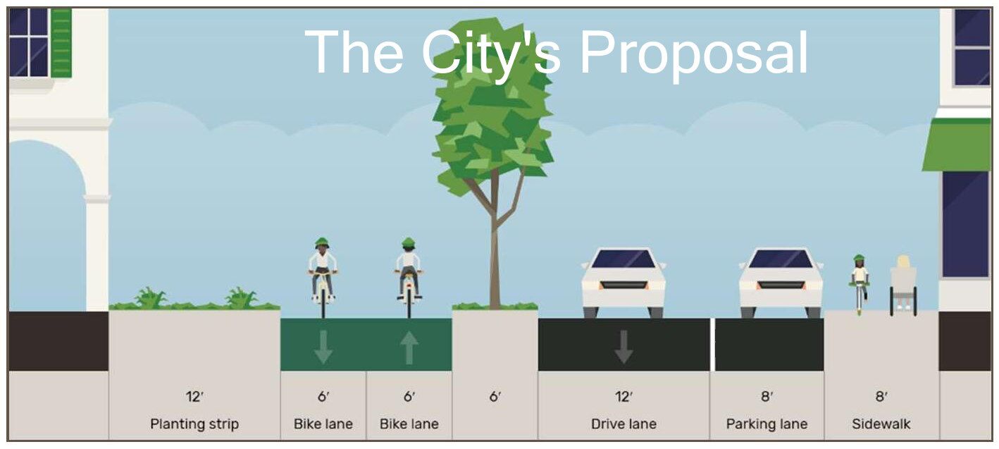
A bucolic view of the City’s proposal for L Street as a one-way road. The little white cars are the size of a sub-compact Honda Fit or Nissan Versa, just 5-1/2 feet wide. The 12-foot-wide pathway plus 6-feet of vegetation between the pathway and the road is now being called a “Linear Park” by the City — an extremely disingenuous use of that term.
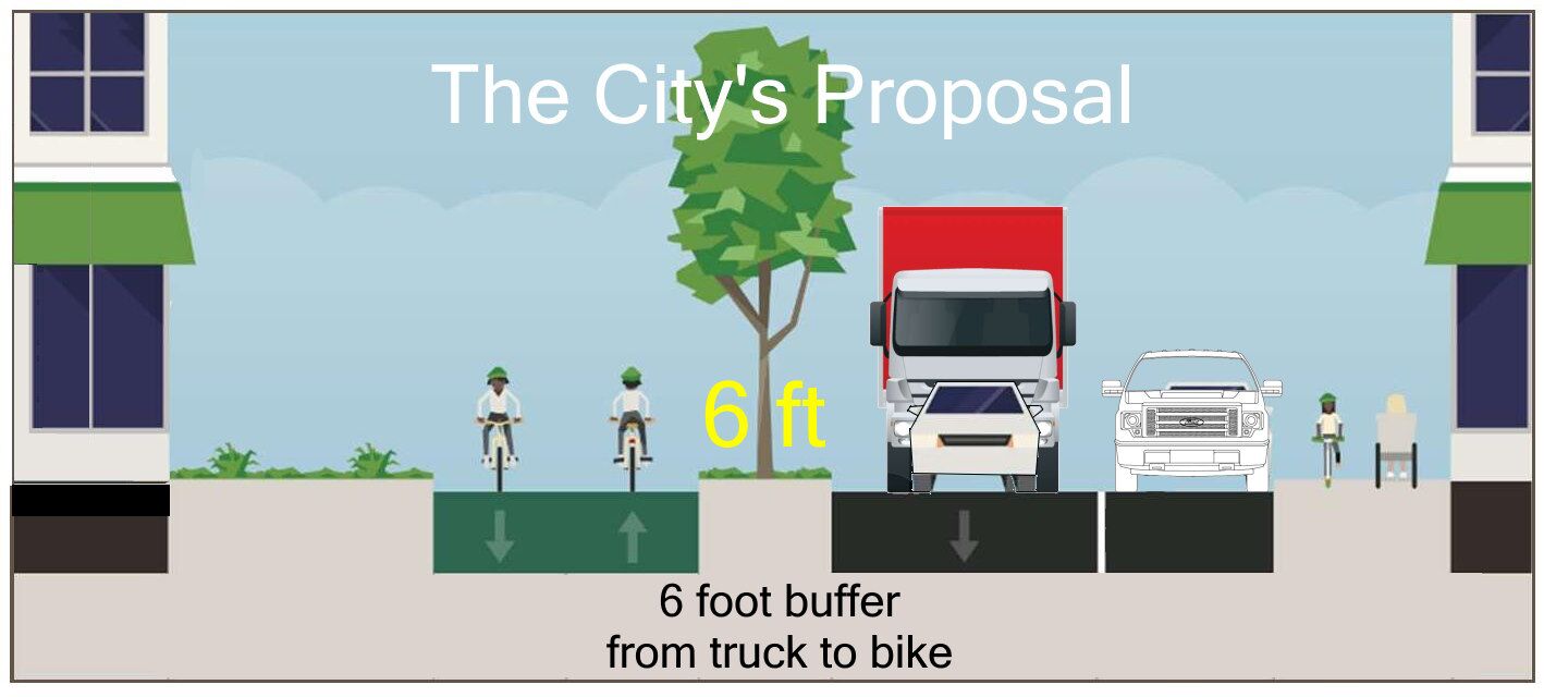
The same image, with real-size vehicles
What could be built — completely theoretical, but in compliance with the Gateway Code
In the current Draft Gateway Plan, the L Street pathway could get just 5 hours of sun — in the middle of August. By mid-September, only 3 hours of sun a day. With a 12-1/2 hour day, if tall buildings were built alongside L Street, the pathway would be in shadow for 9-1/2 hours in the day — in September.
An L Street road with a delivery truck and parking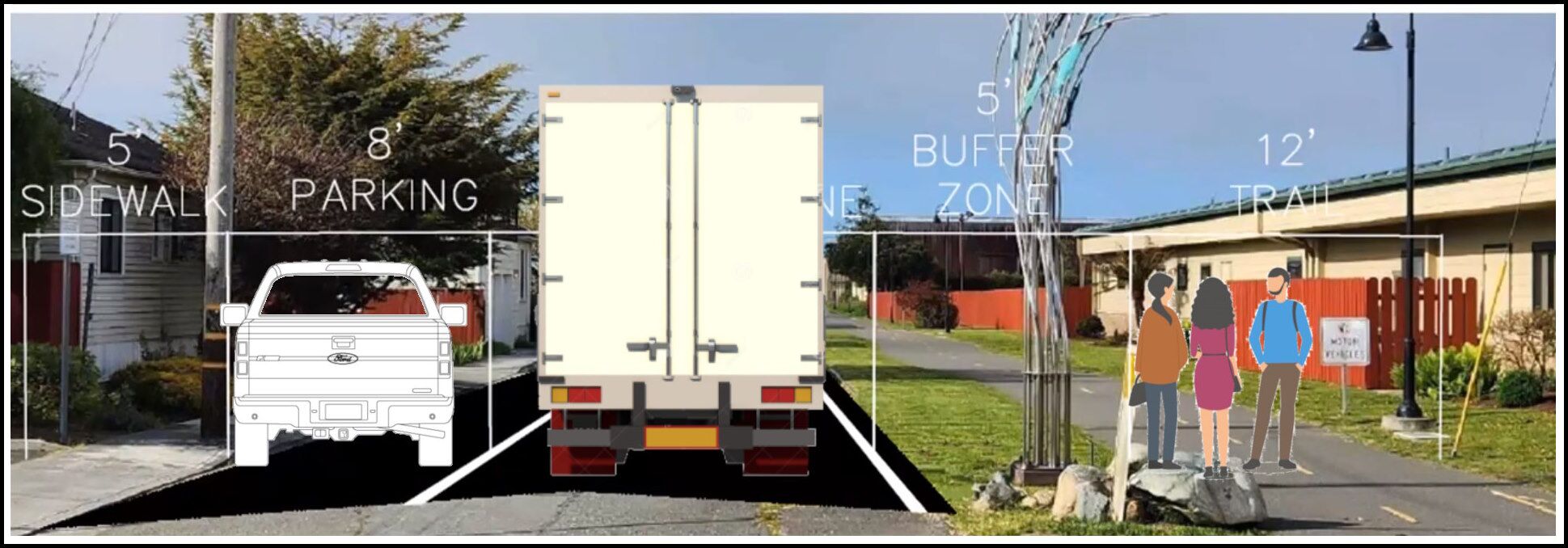
People have met on the pathway, just six feet away from a truck driving past.
Or a walkable, almost car-free “Woonerf”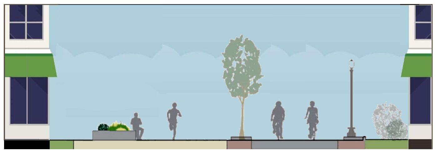
From the “Rail with Trails Feasibility Study” put out by the City of Arcata in 2010. Slightly modified here: The rails have been removed, and the street is on one level, as a walkable woonerf. The gray area of pavement on the right side is open to 5 mph vehicle traffic.
See also:
Linear Park and Woonerf examples for us to look at
The L Street Pathway
The L Street Corridor Linear Park vs. the K-L Street couplet
A selection of maps, aerial views, images, and articles