

To see all articles on the L Street Pathway and Linear Park, click here.

What is the “L Street Pathway”?
On the east side of the Creamery building is a delightful pedestrian area that is used every day by happy Arcata residents. This pathway does not seem to have an official name, but is commonly called the L Street Pathway, even though there’s never been an actual “L Street” in Arcata.
There’s K Street, of course, current a busy thoroughfare that runs between Samoa Boulevard and Alliance Road. And there’s M Street, which runs for just four blocks between Alliance and 10th Street plus a little half-block stub up by the high school on the north side of Alliance, and serves now as a short-cut for people driving or biking along Alliance from Foster Avenue or Westwood and who want to go west on 11th Street.
But in the J-K-L-M sequence, L was more or less left out. The old Arcata & Mad River “Annie & Mary” Railroad ran their tracks along where L Street would have been, and they owned the right of way.
These days there is a two-direction marked bike and stroll asphalt-paved pathway that comes up from Samoa Boulevard, crosses 10th Street, and continues up to Alliance. A person would take this route when walking or driving or biking up to Arcata High. It’s part of the “Rail-with-Trail” route that will eventually go from Blue Lake all the way to Eureka.
Where is the Pathway?
See the photos and aerial maps below to get an idea of where it is. Or just go there and see for yourself.
It’s parallel to K Street and the pathway runs the same length, from Samoa Boulevard to Alliance Road.
Where is L Street?
There is a bit of paved-over roadway that exists between 7th Street and 11th Street, but whether to call it a street or a road or what — that’s another question. It’s more like a pot-holed bad-repair driveway. Unlike M Street, where drivers can (and do) speed along, the piece of L Street that does exist is limited to 5 or 8 miles per hour, just because of the condition of the “street.” There’s also a 1-1/2 block long piece on the north side of Alliance, up by the high school.
It’s clear that L Street is not a through street, as there’s a barrier to going through. What is called “L Street” is in theory 4-1/2-blocks long, but it’s made of three segments: A 3-block segment, a 1-block-long segment, and a 1/2-block segment, intended just for the residents along it who need access. Like a driveway, in that sense. See the photos below.
Why is it called the “L Street” when there’s hardly any street there?
That is a question that has puzzled me. But there’s a bit of a street, and I guess that’s good enough.
I’ve played around with other names. Any other ideas out there?
- L-Trail Pathway
- L-Rail Pathway
The Humboldt County Association of Governments (HCAOG) considers it part of Humboldt Bay Trail. The City of Arcata calls it the Rails with Trails Project — that name dates from 2013-2015. On the current City Gateway FAQ page, they call it the “Rail-with-Trail” — even though that’s kind of an odd use of the singular.
Have any photos?
Please come back to this article for more photos of this spot. Do you have any good photos that you’d like to see here? Get in touch with me — Fred at this website — and we’ll arrange to have them added.
Viewing the images
On all the images here, the Gateway area boundaries are marked in red.
The “L Street Pathway” is in transparent yellow. K Street is shown in blue
If there is a road that parallels the “L Street Pathway” it is shown in transparent orange.

The large orientation. An overview of the entire Gateway area.

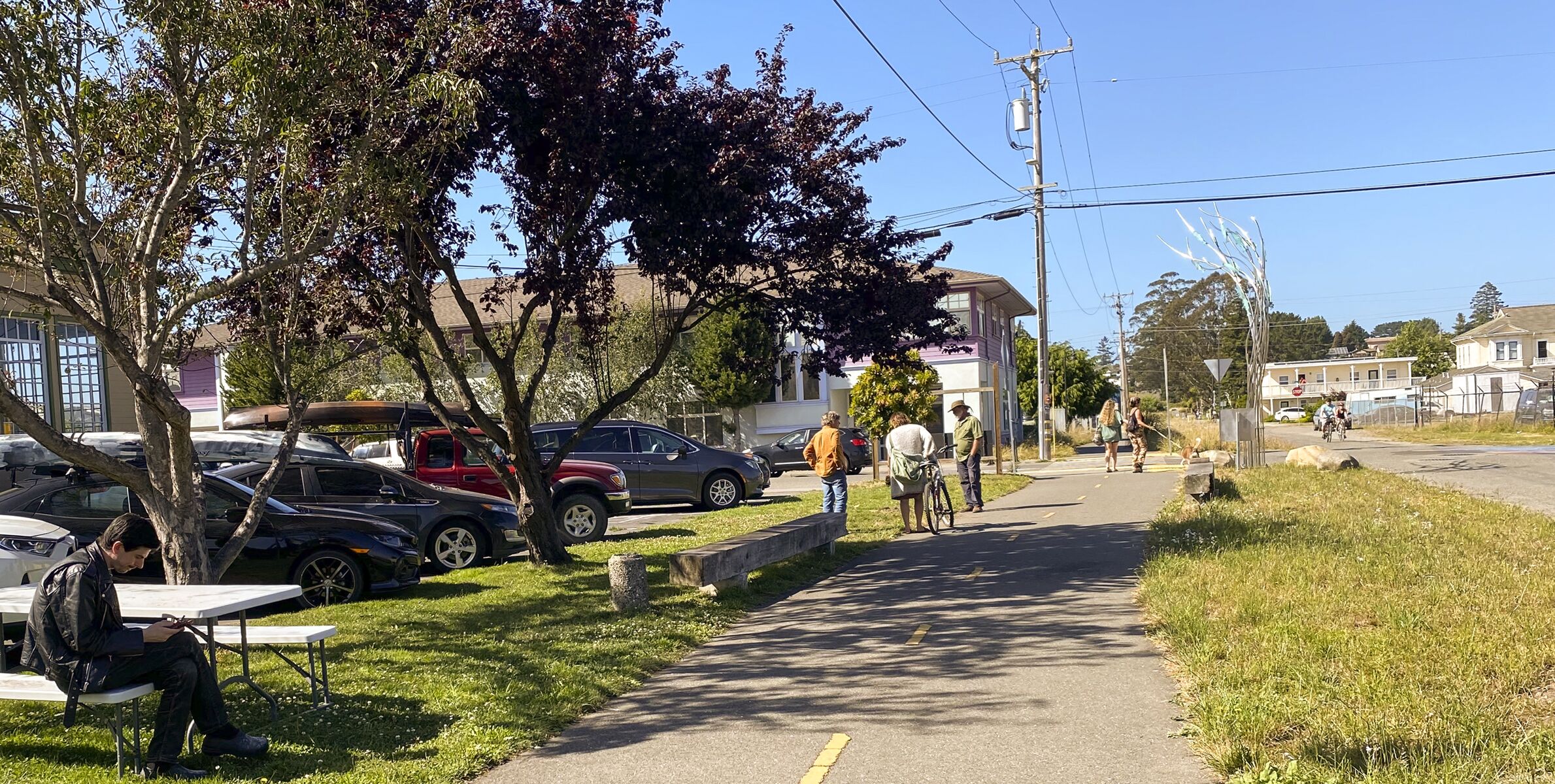
A closer look of the center section of the pathway. Center left is the Creamery Building. Looking north.

Looking South. Here we can see the existing “road” of L Street that runs for 4 blocks, from 11th to 7th Streets. As you’ll see in further photos, the “road” is mostly rutted driveway-size rough asphalt and gravel, and not currently a through-road at all.

Here is the north end of the “L Street Pathway.” We can note that there is no actual street for the first 2-1/2 blocks, the upper section where the pathway goes to Alliance Road. On the other (north) side of Alliance is a path that goes up to Arcata High School.

The middle section of the “L Street Pathway” — here it is alongside the “road” of L Street (on this image in Orange).

Continuing south. Here we see the end of the 3-block length of L Street.

And the south end of the “L Street Pathway” where it encounters Samoa Boulevard, On the other side of Samoa the path continues on its way to the Arcata Marsh. At the top of the image there’s a snippet of the paved portion of the paved portion of L Street where it ends at 7th Street.

Here’s the view of the pathway, on the streetview from 11th Street. The tan building on the left is gone — it’s a parking lot where the data center is now, behind a spike-top fence. The home on the right is one of 4 single-family residences in the parcels along 11th Street that is likely slated for removal, as development comes to 11th Street. The old railroad crossing light is still there.

And looking south at the start of L Street. What you see in the middle, with the shared bike logos painted on the asphalt, is actually the current road of what we can call L Street. There’s the back of the stop sign there as you can see at center-left.


Here’s the intersection of the “L Street Pathway” and 10th. It’s clear that L Street is not a through street, as there’s a barrier to going through. So it’s not a 4-block street now — it’s a 3-block-long street and a 1 block-long stub, intended just for the residents along it who need access. Like a driveway, in that sense.
The old railroad tracks are still visible, and there is not yet a formal pathway. The old Seely & Titlow woodworkers’ building is on the right, and North Bay Automotive is across the street on the right.

Here on L Street on the other side of the barrier at 10th Street, heading South.
Here the bike/walk pathway is shown on the right side.

Going further down L Street. Northcoast Children’s Services is on the right.
The storage units on the left will likely be removed and the parcel will be utilized for new development.
From in front of The Pub restaurant. Northcoast Children’s Services is along the path on the next block.


Looking south. On the right is the former Tomas Building, now the site of the Open Door Clinic.

And looking north, from just along the path up from 11th Street.