The L Street Pathway
Meanwhile, the City documents and material are promoting just this one design.
Having K Street and L Street be one-way one-lane roads will undoubtedly be better for traffic flow.
At least it will until a UPS truck has to stop for a delivery, or until a minor traffic accident stops everything.
With a delivery truck blocking the traffic lane, cars behind it will just have to wait.
The L Street Pathway could be a community jewel in the heart of the Gateway area. The City wants it to be a high-traffic road, taking all the southbound car and truck volume from Alliance Road to Samoa Boulevard. Can you envision a “walking mall” with restaurants and shops, activities and entertainment, located along a tree-lined linear park?
When parcels such as where AmeriGas now is at 6-7th at K Street, the lot behind the former Tomas building on L, the storage units caddy-corner from the Creamery Building, and the Ag Sales building at 11th & L are all infilled and re-developed with park-facing storefronts, just imagine how delightful this area could be. It is already delightful. It is a vast opportunity for Arcata to create a focus for vibrant life, for tourism, for the arts, for our people. See the article here with maps and photos.
It’s what cities all over the world are striving to achieve, and it’s right here ready for us in our own town. Unless, of course, our City determines it really needs to be turned into a designated southbound truck route.
This is a big topic, but when it comes down to the basics it’s actually fairly simple.
Is the K Street & L Street couplet feasible? And, if not, why not?

This is from Page 75 in the December 2021 draft Gateway plan. As it says:
“The implementation of the K Street and L Street couplets allows for more space for bicycle and pedestrian facilities while also improving traffic flow at intersections like 11th Street and K Street that would otherwise perform poorly with increased congestion in the future.”
Here are the issues that are not talked about:
- The City does not have the rights-of-way to build roads at these locations. There are railroad rights-of-way and there are rights-of-way from individual landowners. From what I’ve heard, the likelihood of getting the rights from the individual landowners is very low. The City has stated clearly that they will not utilize Eminent Domain laws. In neither of two alternatives presented in the draft plan (image above) does the City have the property rights to build the road as shown.
- The L Street Pathway is a tremendous opportunity for creating the walkable, bikeable, vibrant community that the Gateway plan portends to promote. The L Street pathway is exactly what cities are attempting to create by removing existing roadways. And we already have the makings of it, right in front of us.
- The K Street & L Street couplet ignores the wishes of the Creamery District community, which has been working for years to improve this area and increase its attractiveness to the community.
- The economic and social value of the L Street Pathway as a “Linear Park” is being ignored. The Gateway area is expected to contain upwards of 8,000 people, and there are very little provisions for public meeting-space type parks. The L Street Pathway location and orientation is ideal. Or, we can say, it is more than ideal. It is superb.
- A K Street & L Street couplet would create a new road on “L Street” where there currently is no road. See the photos here if you are unsure of its current configuration. Yes, it it becomes a real road there’d be opportunities for storefronts and commercial endeavors along that road, just as there would be on the central-to-Gateway roads such as K Street, 11th Street, 10th, 9th, and 8th. But will Arcata need more storefronts along a trafficked road? Could this instead be a “walkable mall”? Absolutely, yes.
Meanwhile, the City documents and material are promoting just this one design. Having K Street and L Street be one-way one-lane roads will undoubtedly be better for traffic flow. At least it will until a UPS truck has to stop for a delivery, or until a minor traffic accident stops everything. At that point everyone would wish that they had another lane to pull out into, even if it meant having a police or a flagger-person there to temporarily direct traffic. With only one lane, and with parked cars on one side and trees and bushes on the bike-lane separator on the other side, the traffic flow on a single lane is pretty much stuck.
And why not bring us some alternatives, so the Transportation Safety Committee and the Economic Development Committee and the Planning Commission — and the Creamery District people, and the homeowners along the current L “street” driveway, and the people of all of Arcata — can decide?
Well, it turns out that a “Plan B” has been talked about at least since January. And requested by me in a letter to the Planning Commission and the City Council back on June 9 — a letter which, by the way, finally entered the public record on August 2, 2022, only about two months later.
And a “Plan B” as a potential alternative has been discussed numerous times at Committee meetings during this time also.
I can imagine what a “Plan B” might be — but could we see it, on paper? As a design? There could be other alternatives also, as we don’t necessarily have to choose between just one of two selections. If there are other good ideas, we’d like to hear them.
Why does the City attempt to mislead us?
Why does Arcata’s Community Development Department insist on being misleading and false in their presentations of fact? Why not just tell the truth, present the facts as they are, and leave it up to us — the public — to either agree or disagree?
Tell me, Reader: After encountering deceptions, aren’t you far more suspicious of everything that is presented to you from that point forward? If asked to accept something which either you know from the start to not be valid or you find out later was based on beliefs without merit — won’t your views of all that follows be accompanied with skepticism?
My skepticism and distrust started when when I read the opening page — the very first page — of the December 2021 draft Gateway plan. And — based on what the Community Development Department continues to promote as “truth” — that level of distrust has only increased.
The City’s FAQ statement on the L Street Pathway
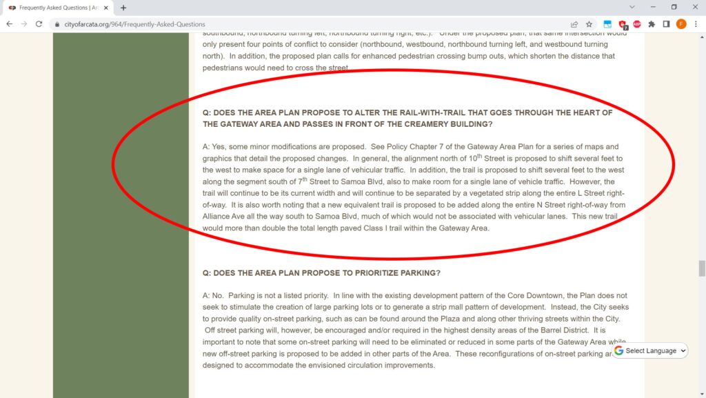
Consider the following, from the City’s Frequently Asked Questions (FAQ) page, from December 20, 2021. I added the highlight in red.

Q: DOES THE AREA PLAN PROPOSE TO ALTER THE RAIL-WITH-TRAIL THAT GOES THROUGH THE HEART OF THE GATEWAY AREA AND PASSES IN FRONT OF THE CREAMERY BUILDING?
A: Yes, some minor modifications are proposed. See Policy Chapter 7 of the Gateway Area Plan for a series of maps and graphics that detail the proposed changes. In general, the alignment north of 10th Street is proposed to shift several feet to the west to make space for a single lane of vehicular traffic. In addition, the trail is proposed to shift several feet to the west along the segment south of 7th Street to Samoa Blvd, also to make room for a single lane of vehicle traffic. However, the trail will continue to be its current width and will continue to be separated by a vegetated strip along the entire L Street right-of-way. It is also worth noting that a new equivalent trail is proposed to be added along the entire N Street right-of-way from Alliance Ave all the way south to Samoa Blvd, much of which would not be associated with vehicular lanes. This new trail would more than double the total length paved Class I trail within the Gateway Area.
- Start with the first sentence, six words.
“A: Yes, some minor modifications are proposed.”
Does the City’s Community Development Department consider adding all the southbound traffic that’s currently on K Street onto a newly-constructed L Street, alongside the current L Street Pathway — with delivery trucks, semi-trucks, commuter traffic, all vehicular activity moving from Foster Avenue, Westwood, people driving to Highway 101 from the Bottoms and west 11th Street . . . to be a “minor modification” ?
 Does the City’s Community Development Department consider putting the southbound traffic of all of what’s on Alliance Road to be going past this to be a “minor modification” ?

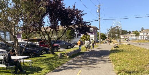
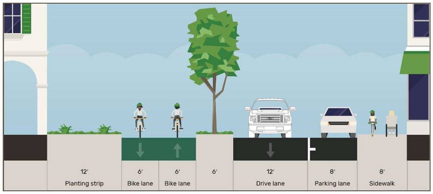
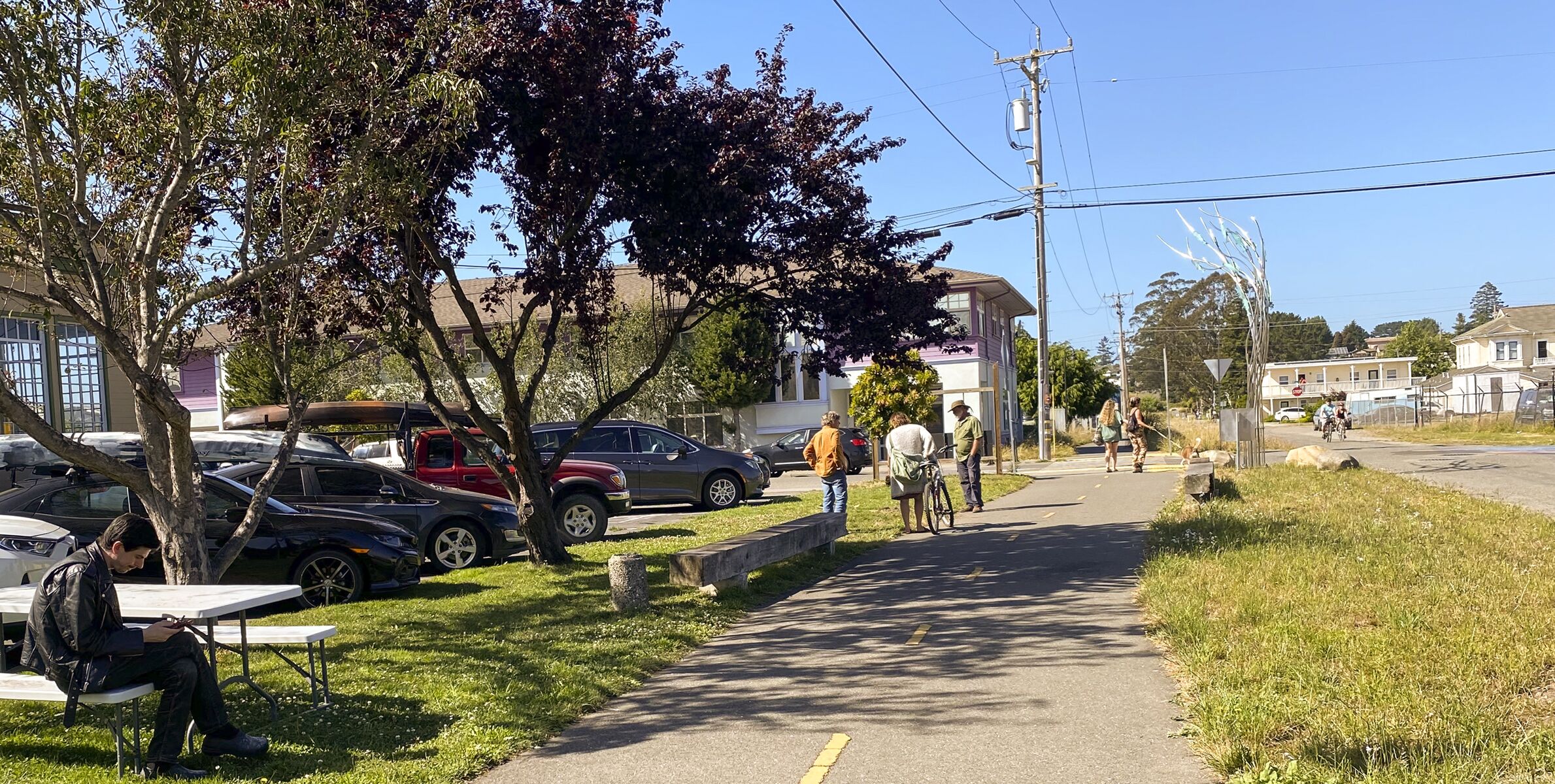
How does the photo above turn into… this?
Is there a sense that this looks like “Anywhere, CA” ?
The proposal for L Street
Here are some other images of the potential streetscape for L Street. Because the white car shown in the City’s images is actually the size of a sub-compact and thus is slightly misleading, I’ve put in some other vehicle types, at the same scale.


And this is what is there now.


