What is the Redwood City Downtown Precise Plan document?
The Redwood City Downtown Precise Plan (DTTP) is a 194-page PDF document, very dense in layout. It may be considered to be the equivalent of a 300 or 400 page book. There’s a huge amount of information there, yet it is well-organized and easy to read. The content can be skimmed, with the extensive built-in graphics making it easy to find items of interest. It is extremely specific in terms of what Redwood City wants developers to follow in their designs.
How can I read the full Redwood City Downtown Precise Plan document ?
Method A:
The Redwood City Downtown Precise Plan can be easily accessed on the Redwood City website by opening the entire plan document here [or stored on this website here]. The Table of Contents is on Page 5. To look up a subject of particular interest to you, you can use the search (Ctrl-F or Command-F) on your viewer/browser to look up a word or phrase, and then jump to that section of the document. As examples, a search for “bike lane” yields 10 entries; for “urbanism” yields 14; for “shadow” yields 20.
Method B:
Here’s the entire document. You can scroll through it, enlarge (zoom), pan left and right, make full screen, search for words or phrases, and download it if you want.
Instructions and Suggestions:
- You can go directly to a Page by typing that number in the page number box and pressing Enter.
- The ↑ ↓ arrows will go up/down one page at a time. (Arrows may not be on cell screens.) The – + buttons will reduce/enlarge the screen, or the Zoom . Sorry, pinch doesn’t work.
- Thumbnails: Press or click the
 thumbnail icon (at the upper left) to turn thumbnails on or off.
 - Upside-down? Many of the posters photos are rotated or upside-down. To view them correctly, press/click the
 Tools icon — that will take you to the options for rotating. Rotate two times to correct a photo that’s upside-down.
 - You can cut-and-paste from this PDF viewer.
- Search: Want to search for something? Use the
 Search button.
 - Print a single page or range of pages. Or Download the document.
[Note to the Reader: Many of the images in this article are fuzzy. This is from the process of converting individual PDF pages to photo images (jpg). This can be improved. If there is enough interest, I can edit and convert this article use the embedded PDF pages. The results would be sharper and easier to read. It that would help you, let me know.]
How long did it take to create?
Redwood City’s Downtown Precise Plan is the result of much concentrated effort through community workshops and by 5 city upper-level staff members and 19 city staff employees, plus other city committees and numerous consultants.
In total, the process took approximately 3 years to develop the Form-Based Code, plus another year or more for the Environmental Impact Report (EIR) — a total of 3 or 4 years to develop a form-based code and an EIR.
Can Arcata benefit from Redwood City’s Precise Plan?
Comparing the December 2021 draft Gateway Area Plan Arcata with the Redwood City’s Precise Plan
When reading through the Redwood City Precise Plan, the amount of detail and degree of thoughtful consideration are very obvious. Parts of the plan refer to existing structures — and the need for new structures to be compatible with them — on a neighborhood basis, at times on a block-by-block basis.
By contrast, Arcata’s draft Gateway Area Plan has four districts, with the main difference being that of height. (The proposed maximum height is either 5, 6, 7, or eight stories, based on the district.) In the Arcata plan, there are currently no requirements for differing architectural styles or features within the entire plan. In the Redwood City plan, there are dozens of very specific requirements.
In essence, the Redwood City plan is fine-tuned. The Arcata plan is (at this time) generalized and non-specific.
Pages from the Redwood City DTTP
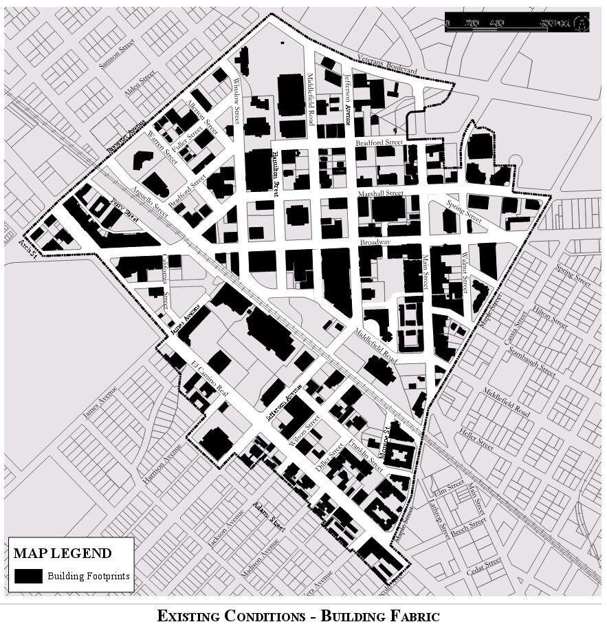
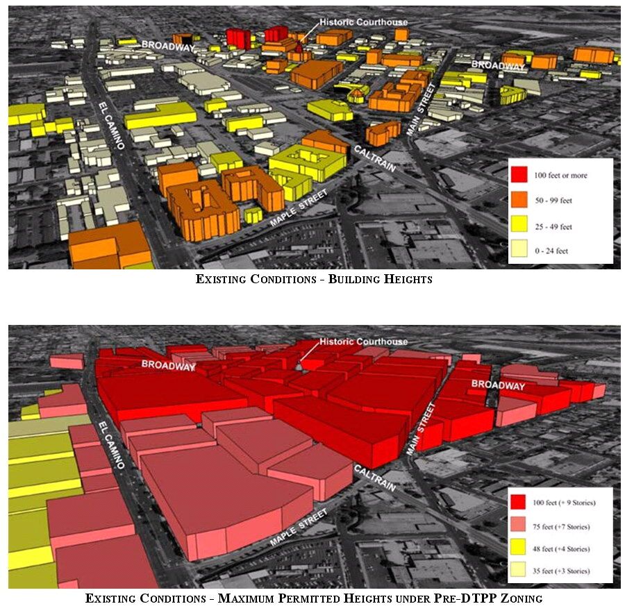
Pages 5-7 Existing buildings and proposed building heights




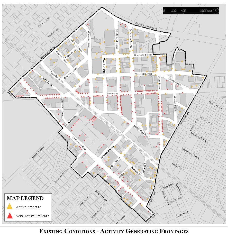
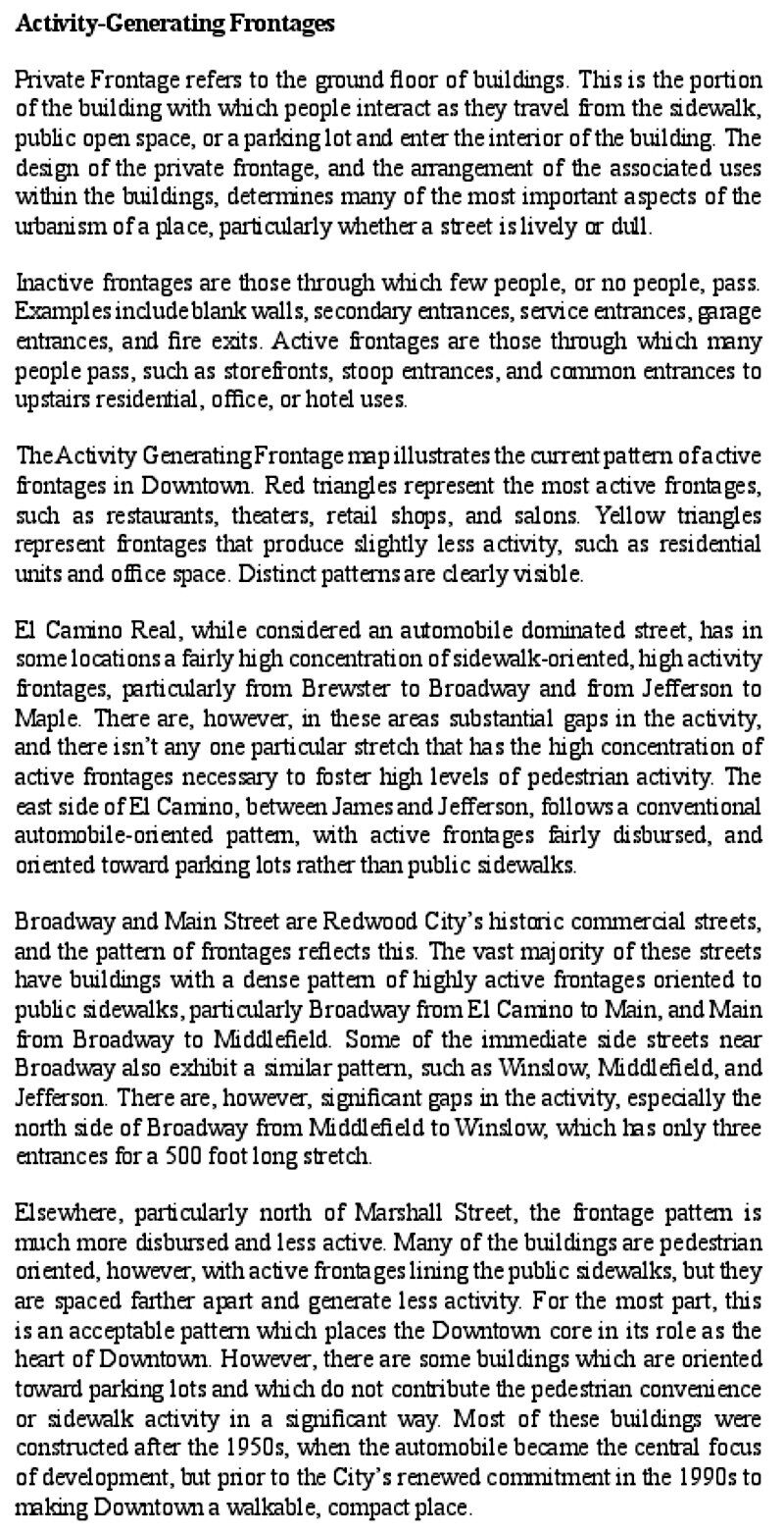
Page 8 – Activity Generating Frontages.
Which streets should have commercial spaces on the first floor ?
There are 23 public open space areas in the plan. 96% of all parcels in the plan are within a 3 minute walk of an open space. Of the 23 public open space, 10 are designated as “Shadow Sensitive.” Maximum permitted building heights are reduced near these spaces.


This map shows building heights of 5 to 12 stories. In Arcata, this might correspond to 2-6 stories. Note the Yellow zones along the major commercial roads and along much of the perimeter. This designates where buildings will have a 3-story height along the street, and then a 5 to 8 story height behind that. In Arcata, this might correspond to a 2 Story height along the pedestrian-oriented streets, and a 4 Story maximum height along commercial streets.


