Again and again and again, we are told the Foster Avenue Extension was 20 or 30 years in its planning. And that if it hadn’t been planned for from the beginning, it never would have happened.
And we’re told the same long-range planning process applies to Gateway’s theoretical L Street — the proposed couplet new road that cuts through the heart of the Creamery Arts district… and makes a mockery of the serene spot that’s been created over these years.
For all the articles on the L Street corridor Linear Park, see here.
To see maps and photos of L Street, see here and here.
To see what planners envisioned in 2010, see L Street – 2010 Rail with Trail Feasibility Study
To see the cold terms of how a traffic engineer views this delightful area of Arcata, see here
To sign a petition to keep a truck-route road out of the L Street corridor and to continue the creation of a Linear Park there, click here or go to arcatalinearpark.org
The Foster Avenue Extension and the proposed new L Street couplet are different roads, for different purposes, in very different environments, and with completely sets of buildings (both existing and proposed) alongside them. Consequently they will have very different planning processes. The situations are 100% different – they are like night and day. There is very little in common between the two roads.
Gateway’s L Street proposal vs. Foster Avenue – in pictures
The Foster Avenue Extension was built on raw, open land. The City obtained the rights of way, and built the road where they wanted to see it built. There were no existing buildings to get in the way of its design.
In contrast, L Street would be placed in a built-up neighborhood. The rights of way are fixed. The City does not have the right of way in the northern section to build this road. The road would go through a marshland, and it would require Coastal Commission approval.
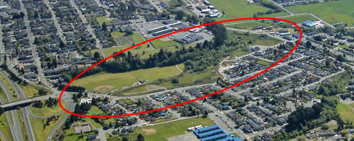
Here’s the area where the Foster Avenue Extension was constructed, before the road was built. The photo is from around 1990. As you can see, it is largely open space.
And here’s what got built. Photo from ~2017, before construction of the Sunset Terrace Apartments and the new Open Door Clinic. The apartments are located at the center of this image, between Foster Avenue and Sunset Avenue. The Open Door Clinic is just to the right of the traffic circle, inside the ellipse at the lower left.
In this image, South is at the top. Highway 101 is at the left, with the Sunset Avenue interchange.
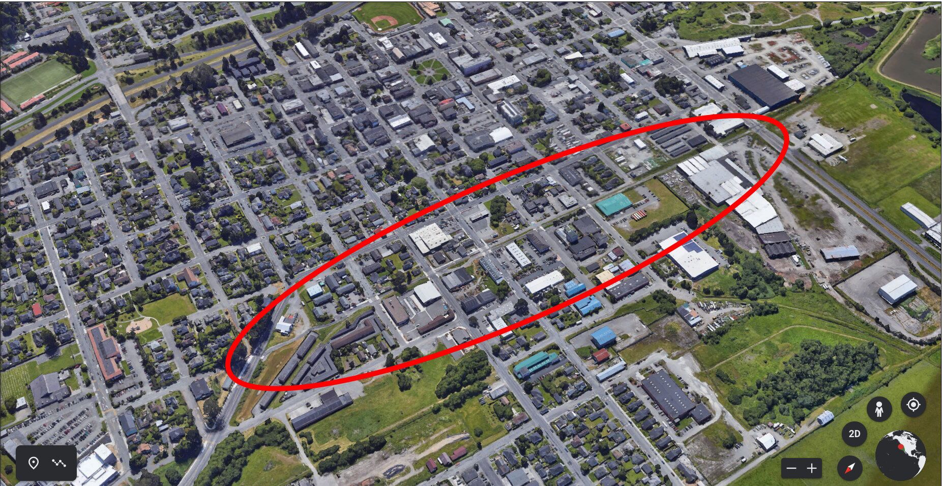
And here is where a new proposed L Street would be built.
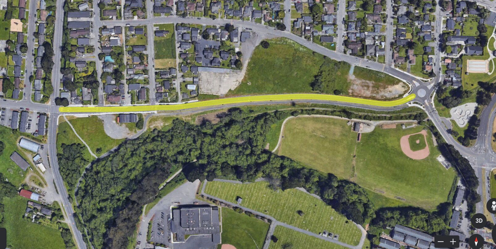
Here’s Foster Avenue after being built. North is at the top. After the road was built, the area between Foster (yellow line) and Sunset Avenue above it has been filled in with apartments and (near the traffic circle) the Open Door Clinic building.

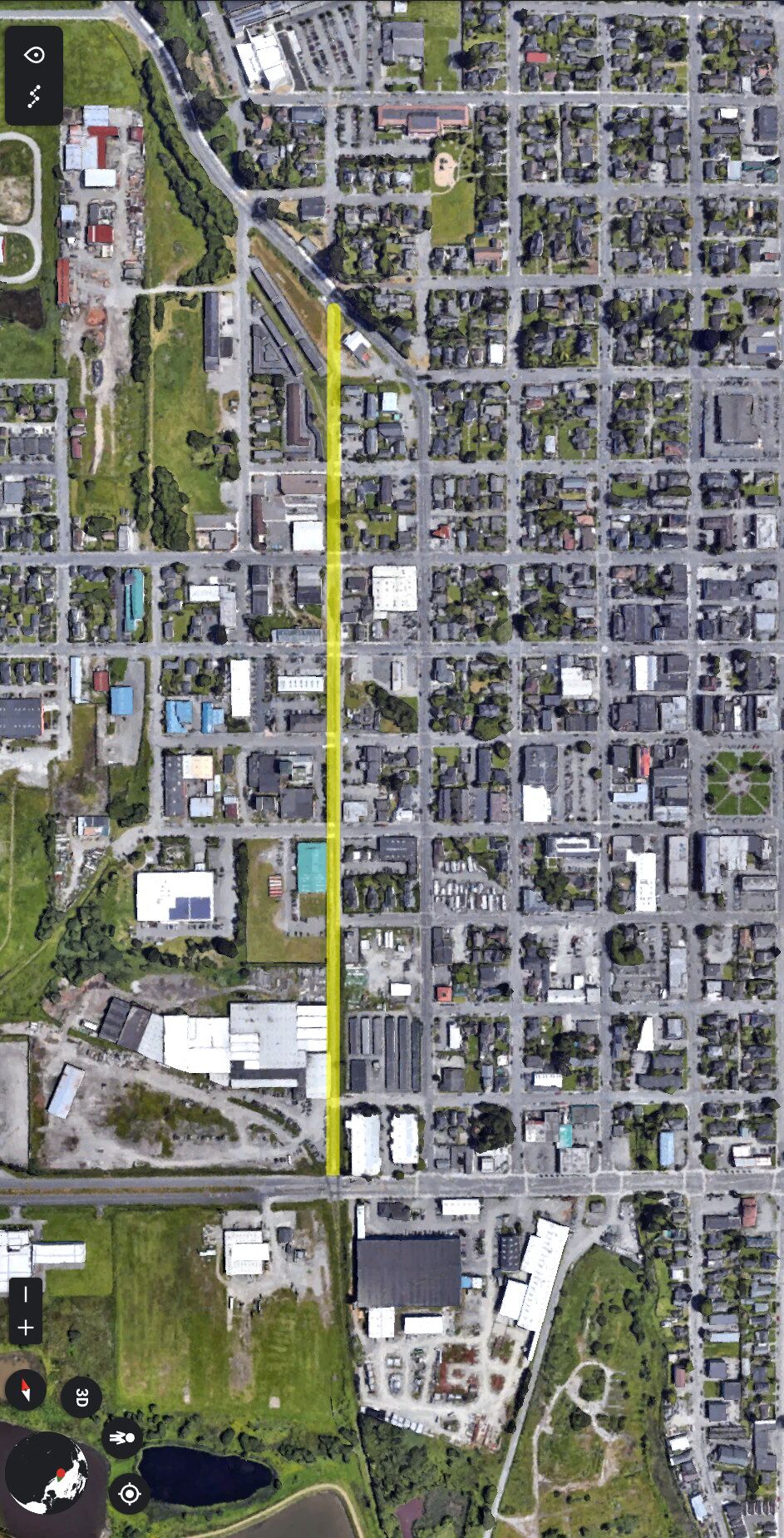
And here’s where the proposed truck route of L Street would be. An almost completely built-up neighborhood.


