This page contains an assortment of photographs and aerial views of the L Street Pathway area. It will be updated as new images come in, so be sure to check back to see what’s new.
A selection of L Street Pathway and Linear Park articles are here.
To sign the Petition for the L Street Corridor Linear Park, click here.
Here’s a basic aerial overview of downtown and headed out to western Arcata. The boundaries of the Gateway area are marked in red.
At the upper right is the Cal Poly Humboldt campus. Upper center is Arcata High School. At the far upper right is the Greenview neighborhood, at the end of 11th Street; below that is the Windsong subdivision. To the right is the long Villa Way street that ends in a cul-de-sac.
HealthSport and a bit of the Arcata Community Center are at the lower right.
In this image, the Plaza is highlighted as a focal point for orientation.

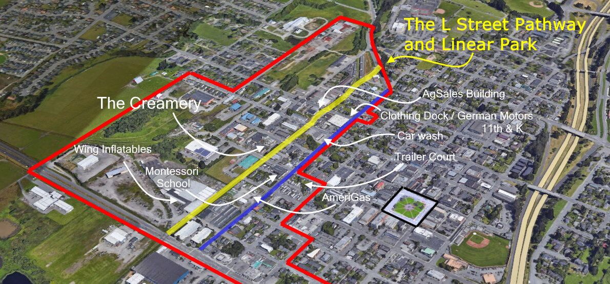
The same image, with more labels of local landmarks along the L Street Pathway and K Street. Prominent is the Creamery Building.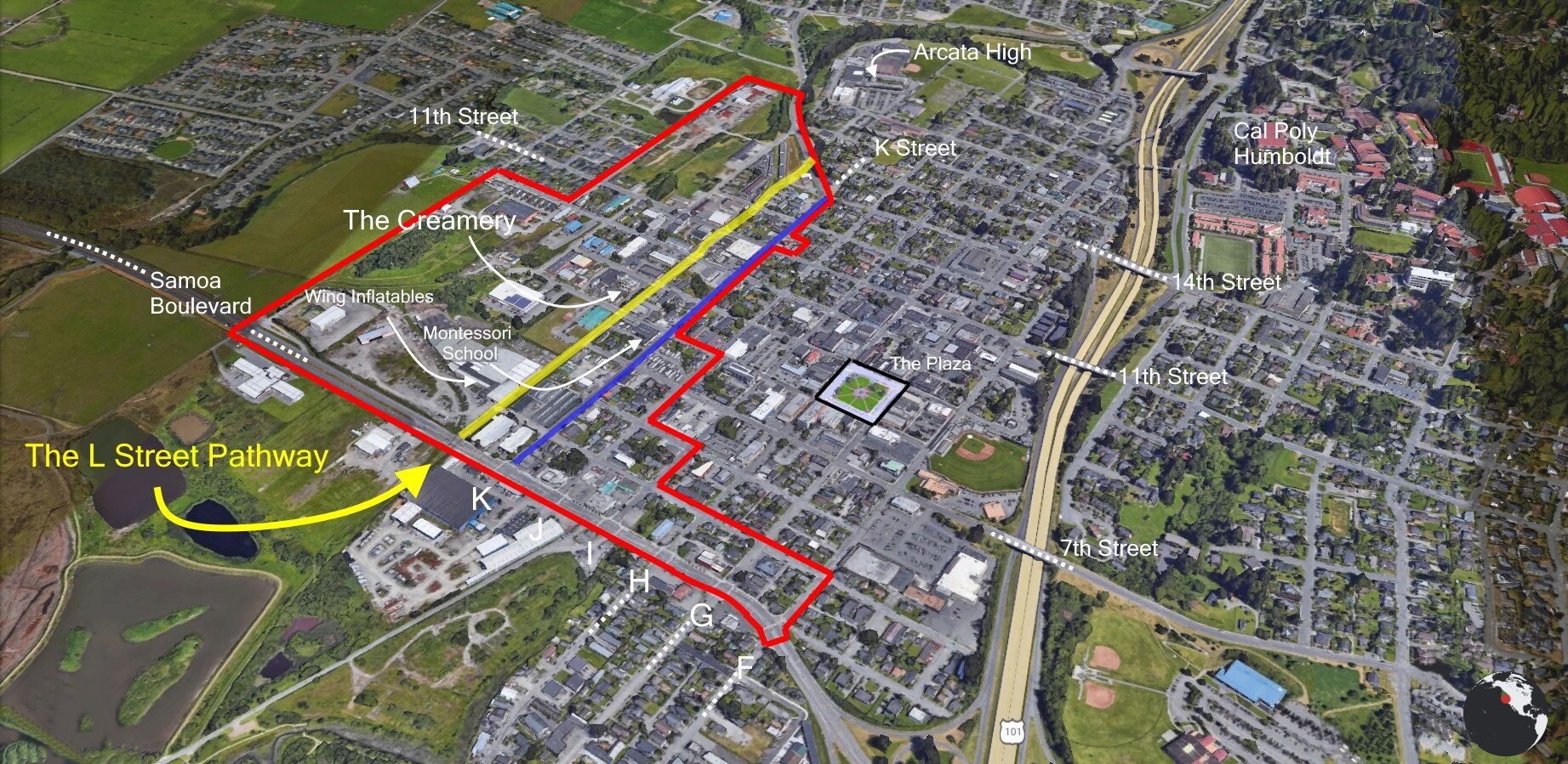
And more labels.
And more labels of buildings and locations.

Closer view.