alongside them. Consequently they will have very different planning processes. The situations are 100% different --they are like night and day. There is very little in common between the two roads. *** WITH AERIAL PHOTOS ***)
The construction of the Foster Avenue Extension has almost nothing in common with the construction of a proposed road along the L Street corridor.
If you want to get the idea, just look at the aerial views.
Click here.
 Again and again and again, we hear it said that the Foster Avenue Extension was 20 or 30 years in its planning, and that if it hadn’t been proposed and planned for then it never would have happened.
The Foster Avenue Extension and the proposed new L Street couplet are different roads, for different purposes, in very different environments, and with completely sets of buildings (both existing and proposed) alongside them. Consequently they will have very different planning processes. The situations are 100% different –they are like night and day. There is very little in common between the two roads.
The repeated attempts to equate the development of the two roads is simplistic and borders on false representation. From an engineer’s perspective, yes, these things have to be thought about. In that way, they are similar — that they both require thought and planning. From the perspective of a planner, though, the two situations have very little to do with one another.
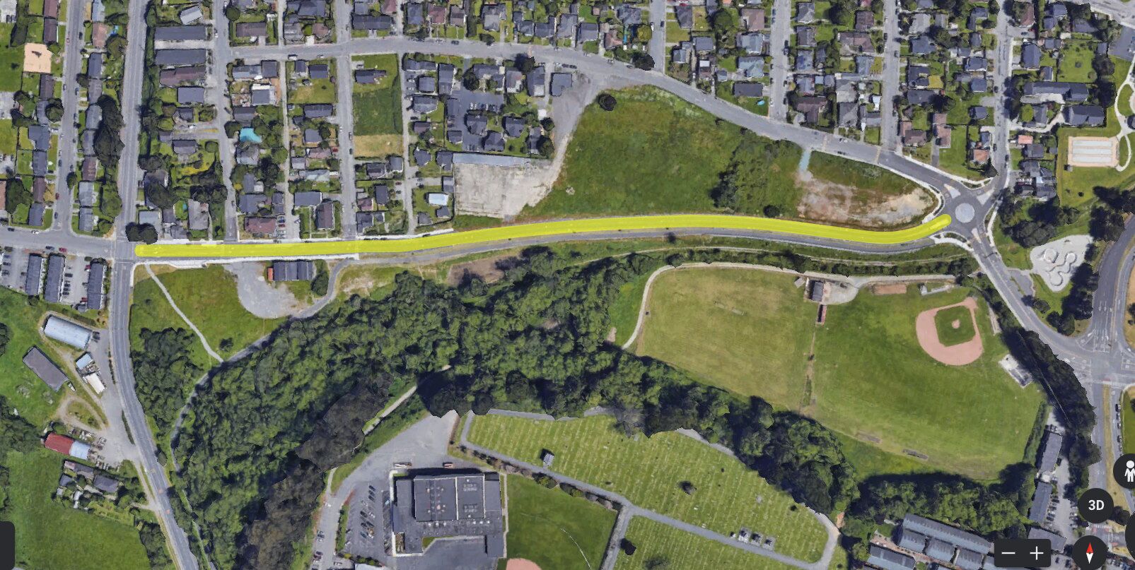
Foster Avenue Extension was built in an area that had never been built up. It was raw land.
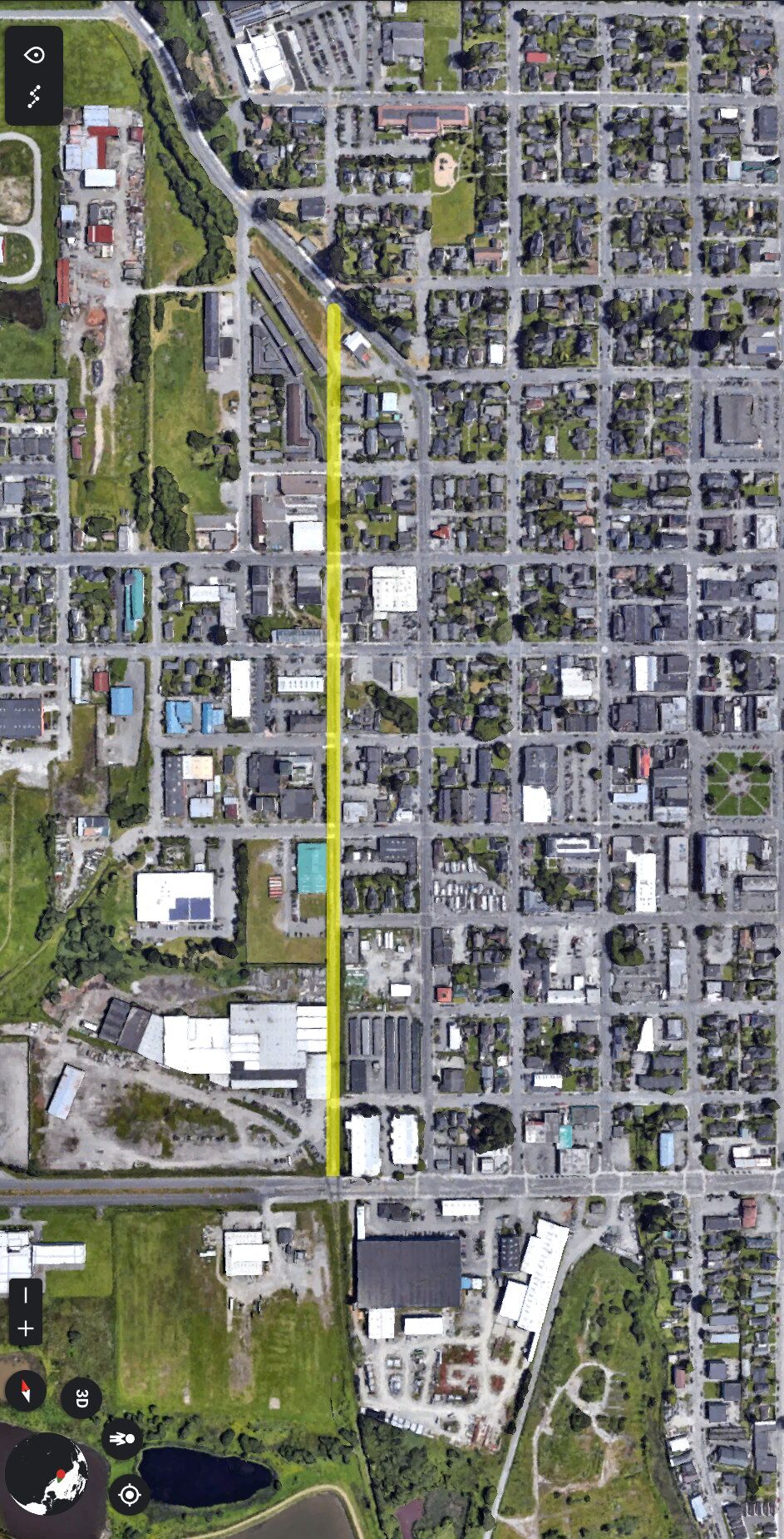
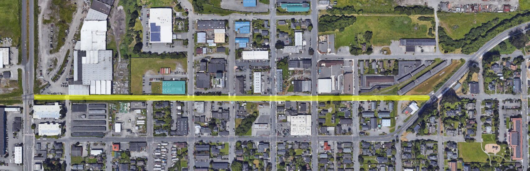
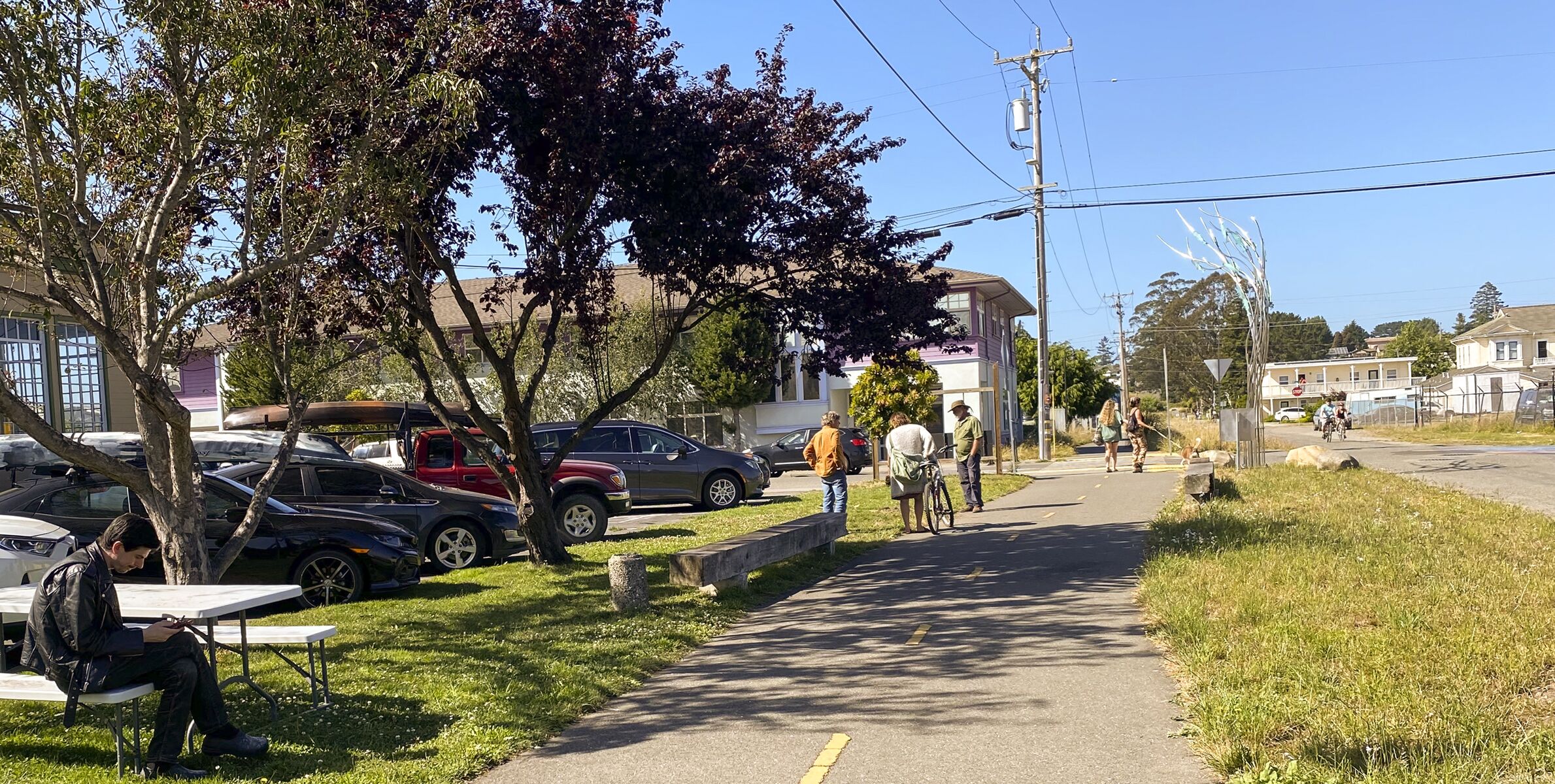
L Street, in distinct contrast, is already built up. Let’s face it: Putting in a truck-route street next to Northcoast Children’s Services, next to the Creamery building, next to the Redwood Raks and the Pub — that is different than a road alongside Shay Park and sports fields.
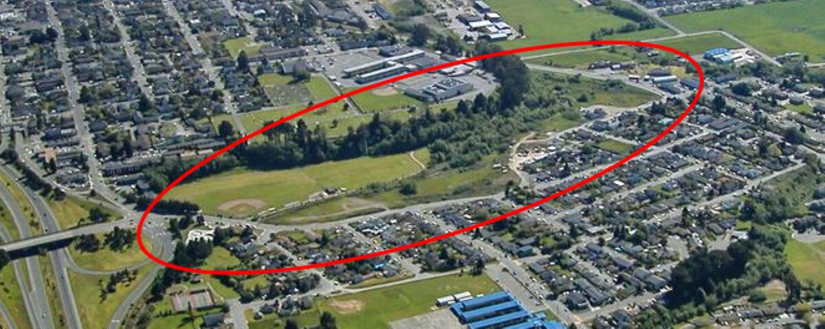
On the Foster Avenue Extension, other than the “Twin Parks Apartments” at the bottom of the hill, the entire southern side of that road is open space — big open space.
- The Foster Avenue Extension was built on raw land, with the majority of its length being on a completely open area — where a road could be put where the planners wanted it.
- The proposed L Street road would be being built in a dense, urban environment, in a corridor that is lined with existing commercial buildings, apartments, and residences.
- The City was able to obtain the rights of way it needed for Foster Avenue without contention. By contrast, the City does not have the rights of way to build an L Street road, and the sellers have indicated that they will not sell.
| Driveway cutouts and street intersections: | |||
| Foster, when built | Foster, after development | L Street corridor, now | |
| 3 | 7 | 22 | |
| Street crossings: | |||
| 0 (and 2 Tees) |
The same as before. Zero crossings and 2 Tees. |
7 (and 1 Tee) |
|
On L Street, there are driveways and streets that are already in use.
In terms of the open space around where the road was built, what does this road have in common…
 … with this road?
Answer: It’s an apples-and-oranges comparisons.
They are different animals.
Other major differences:
The big section of the Foster Avenue Extension has a 65 foot Right of Way. L Street would be 50 feet, except in those places where the City-owned Right of Way is 15 feet, or 4 feet, or Zero.
Foster Avenue has a sidewalk on one side, two 10′-wide traffic lanes, no parking, two 5′-wide unprotected bike lanes, a buffer strip, and a paved walking lane.
We can note that the bike lanes on the Foster Avenue Extension are Class II, with no barriers.
Total width is 55 feet.
The draft Gateway Plan and the draft General Plan contain proposals for the construction of a new road on the L Street corridor, as part of the L-K Street couplet. The proposal is for K Street to be a one-traffic-lane, one-way street for traffic headed north, from Samoa Boulevard to Alliance Road, and for the newly constructed L Street to be a one-traffic-lane, one-way street for traffic headed south.
What would be the configuration of the proposed L Street?
Hard to say. You can see page 92 of the 10/2022 Gateway Draft for one idea. Or see the article here on Arcata1.com “The L Street – K Street Couplet: An engineer’s view.” Here’s one design:
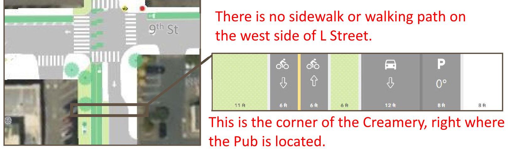
The green areas shown are for vegetation — shrubs, trees, grass, gardens. That is not an area for walking.
This proposed design would need to be updated, as there is no walking area at all where people meet and stroll now. Here is what is there currently:
Here’s a satellite view from Google Earth. Just about at the center of the photo is the Sunset Avenue exit on Highway 101. To the right of that is the sports field for Cal Poly Humboldt and the Foster Avenue Extension.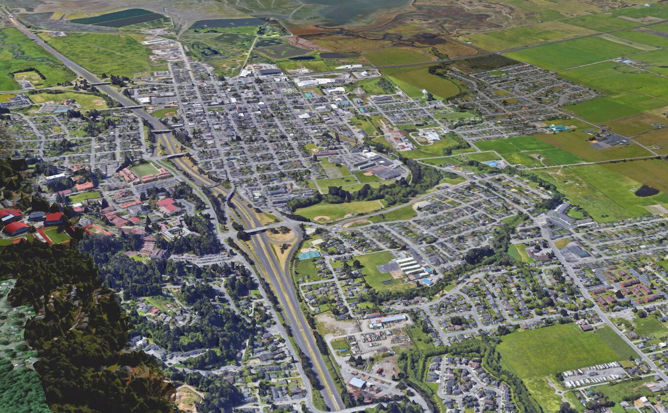
Here’s a closer view. The Sunset Terrace Apartments have not yet been built, which places this satellite view as from prior to 2018. They would be located at the center of this image, between Foster Avenue and Sunset Avenue.

The view before the Foster Avenue Extension: 1990
Here is a similar viewpoint, as an aerial photo, and without the Foster Avenue Extension. The photo dates from approximately 1990-1992 or so. Missing are: Cypress Grove Chevre building (built ~2004), the Janes Creek Meadows sub-division (~2000), and the Windsong sub-division (~1994). Shown is the Villa Way sub-division (~1986-1990).
![]()
Here is the Foster Avenue Extension, as it was built:
And here is where a new road in the L Street Corridor would be built: