

More photos of Arcata during this era will be arriving, so check back later. Do you have films or still photos of Arcata from the past? Please contact me at Fred at Arcata1.com and we can add to the fun of seeing how things used to be.
 Contents
Introduction
In 1970, future videographer and historian Mark Pahuta graduated with a B.A. in History from what was then called Humboldt State College here in Arcata. After receiving an M.F.A. in Cinema at the University of Southern California, he settled in Ridgecrest, California, near Bakersfield, and has had a more than 40-year career in cultural film and video.
Around 2021, Mark Pahuta put up a video of Super-8 film he shot while in Arcata. The film is dated as being from 1968, but more likely it’s from around 1976-1977.
- Prior to 1976, Highway 101 ran on H Street through Arcata, and this film shows the “new” Highway 101 as a freeway.
- Arcata’s population is shown as 9,451. The official census figure for 1970 was 8,985, so it would seem that this sign might be from 1972 or so.
- The sign on the freeway offramp says “Humboldt State College.” We may assume that Caltrans got the name wrong on the sign. The current Cal Poly University Humboldt was “Humboldt State College” until 1972. It was “California State University, Humboldt” until 1974, and then “Humboldt State University” until 2022.
- There are cars in the film that are from the early 1970s.
It’s fun to see what’s changed in Arcata — and what hasn’t.
The film is filled with fun aspects and artifacts from that era, including:
- The grand Masonic and Odd Fellow’s Hall at 9th and G Streets. This building was shared with the City of Arcata as Arcata’s City Hall before the current city hall building was built, in 1967.
- Two-way car traffic around the Plaza, with parking on both sides of the street. Angled parking on the outside of the Plaza — including on G and H Streets — and straight parallel parking on the inside.
- Lumber storage right in town. Multiple beehive “tipi” burners.
- An operating railroad, with an Arcata station.
Still photos
 Still photos from the film were extracted so you can look more closely at the details. In some cases the contrast or hue was enhanced. A few images were made from combining two or more still images from the film.
Here is the corner of 11th and G Streets, with the Arcata Presbyterian Church. We can note the two-way traffic on G Street — and the traffic lights.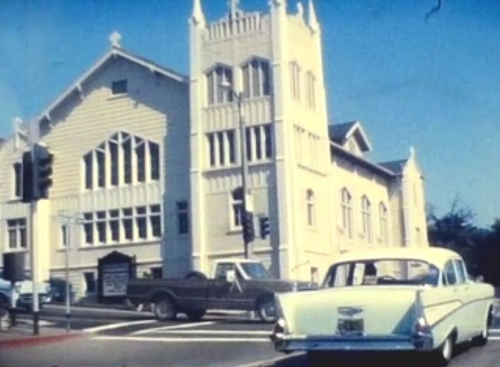
Looking south on H Street. The Arcata Theater on the left.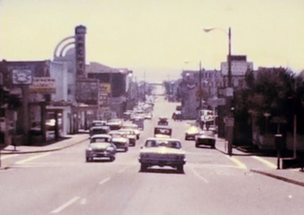
The Masonic and Odd Fellows Hall, at 9th and G Streets. The sign for the Arcata Hotel is ion the left, and the old Arcata Union newspaper office is on G Street, on the right.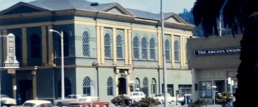
The west side of the Plaza.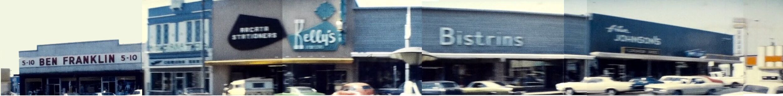


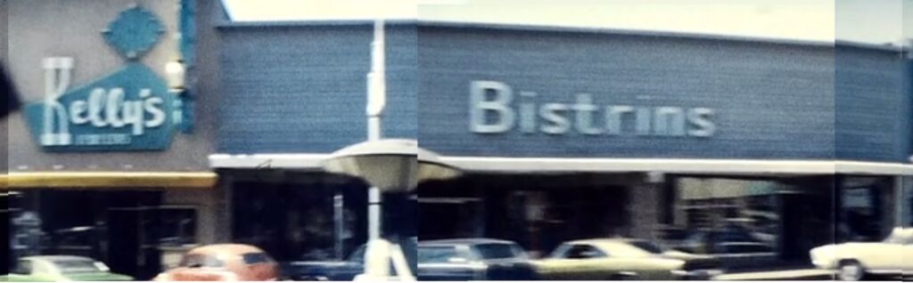
The Epicurian Restaurant. To the right appears to be Canclini’s Shoe Store, later the Plaza Shoe Shop — moved to 7th and G, and closed in 2023 after 75 years in business.
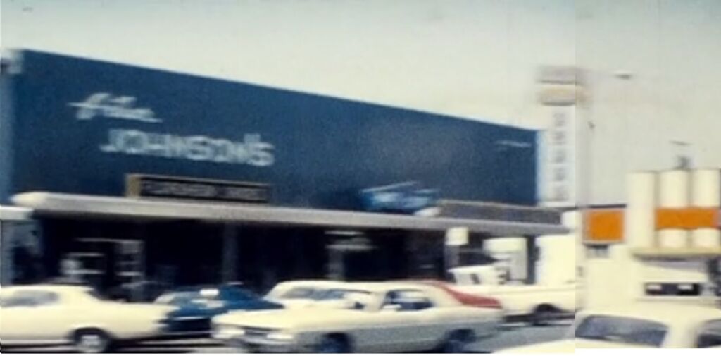
Northtown, with Hutchin’s Grocery. At 16th & G, where the Wildflower Cafe is now, was the original site of Northtown Books — you can see a bit of the sign for Northtown Books in the window.
Jill’s Drive In. This is the building with the funny-shaped roof at 18th and H Streets, currently Raliberto’s Taco Shop and previously all kinds of things, including the Philadelphia Cheesesteak restaurant. Note the logo of the bell in the circle in the lower part of the sign. This indicated that there was a coin telephone inside — as part of the Bell Telephone system.
The Creamery Building, with the Arcata Roller Rink and lumber storage right there too.
The old Arcata freight depot. In the background on the right, the Creamery Building.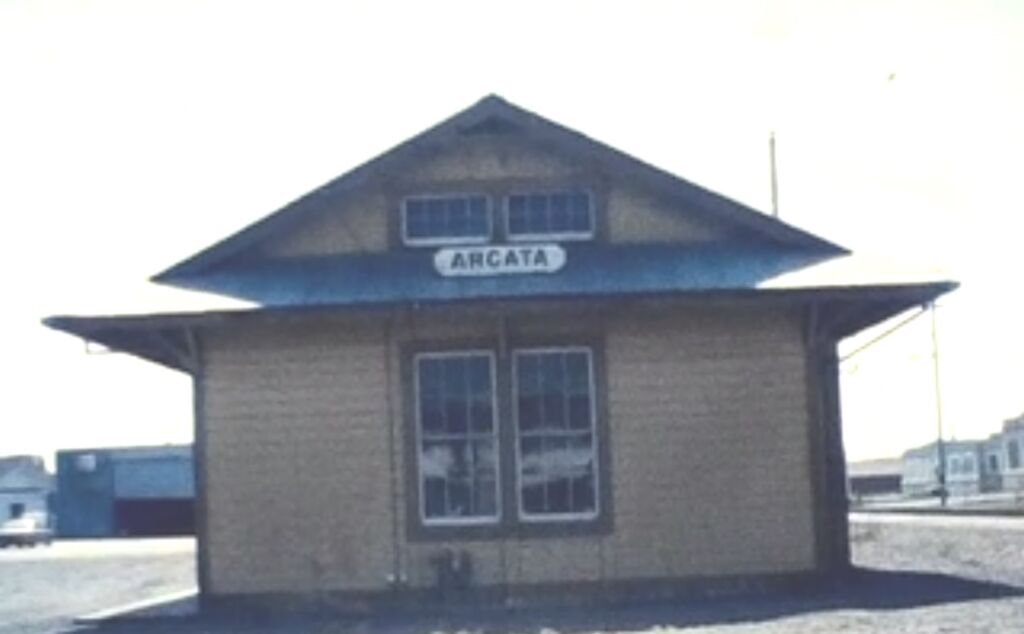
Portuguese Hall. In the foreground, the sign for Copeland Lumber — orange with a black cat. That sign was above the “log cabin” office building that still exists (somewhat) behind the illegal non-code spiked fence of the EdgeConneX Data Center on 11th Street.
Trinity Hospital, on C Street between 13th and 14th Streets. Now the “Trinity Annex” of Cal Poly Humboldt.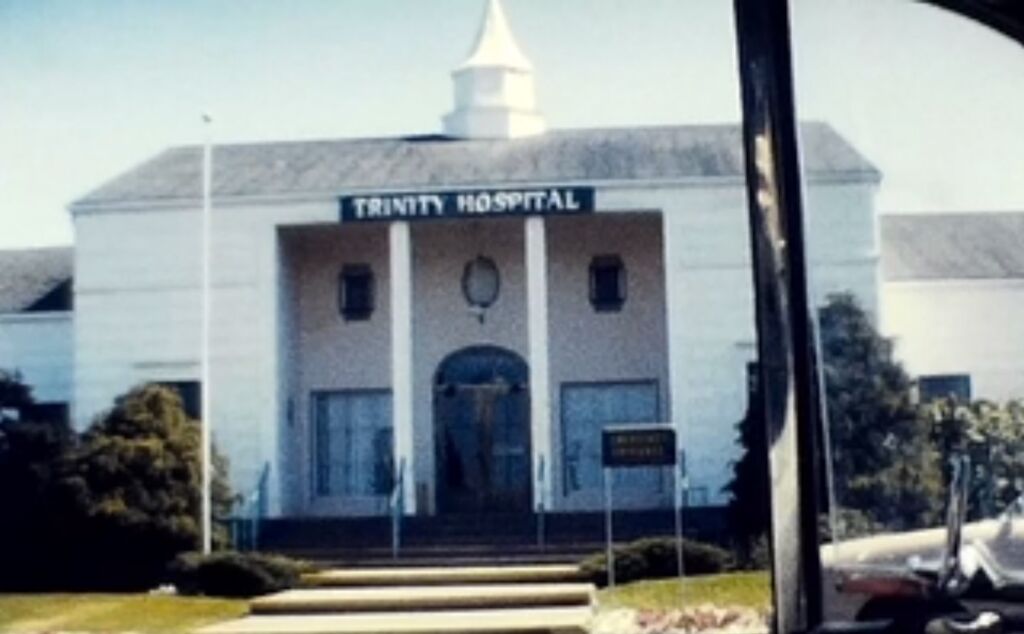
Beehive “tipi” burners for the lumber mills.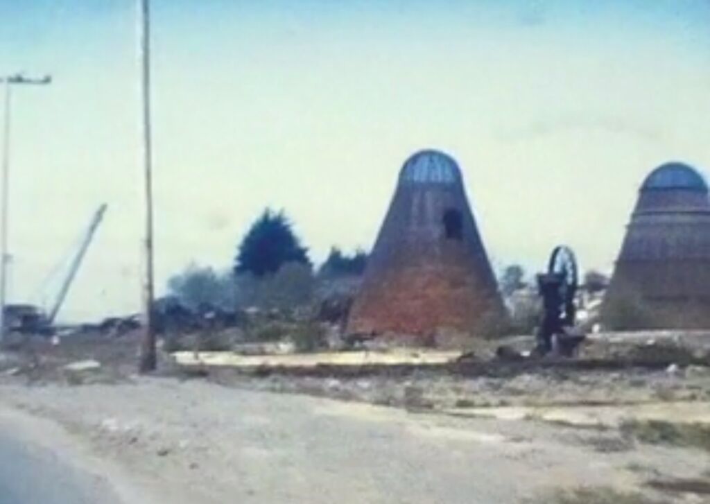

The unused remains of the Hammond Bridge. Now part of the Hammond Trail.
The Film
Thank you to Mark Paduha for filming this, preserving this, and posting it.
Population chart of Arcata
There was a doubling of the population in the post World War II years.
Note the rapid rate of growth from 1960 to 1990 — an increase over 20 years of 145%.
| 1940 | 1,855 | 8.5% |
|---|---|---|
| 1950 | 3,729 | 101.0% |
| 1960 | 5,235 | 40.4% |
| 1970 | 8,985 | 71.6% |
| 1980 | 12,850 | 43.0% |
| 1990 | 15,197 | 18.3% |
| 2000 | 16,651 | 9.6% |
| 2010 | 17,231 | 3.5% |
| 2020 | 18,857 | 9.4% |