Estimated reading time: 6 minutes
Monday, August 21, 2023
Councilmembers and Commissioners:
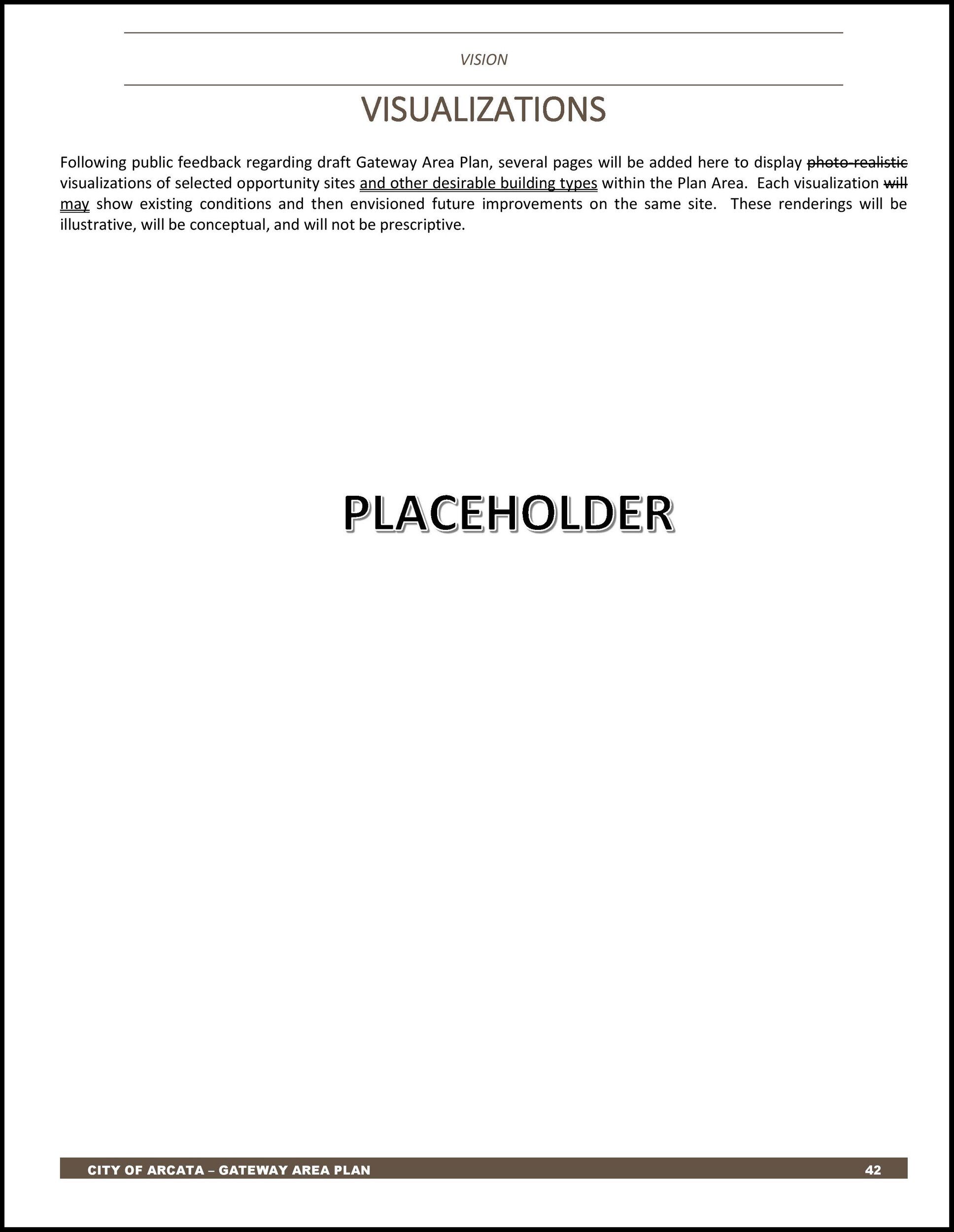
You should be aware that 3D Modeling and Visualizations have been removed from the draft Gateway Area Plan. There was a placeholder page titled “Visualizations” (Page 42) and now that page is gone.
On Tuesday, you are being asked — once again — to discuss building heights. And you do not have the basic tools that any planner would need in order to accomplish this.
You — the Planning Commissioners and the City Councilmembers — have spoken about the need for 3D modeling multiple times. I have spoken and written many times about the absolute requirement for 3D modeling. The Community Development Director has promised versions of 3D modeling on at least ten occasions.
The page (and proposed pages) on which the 3D modeling was to have been displayed has now been removed from the draft Gateway Area Plan.
There are two versions of the 7/11/23 draft Gateway Area Plan in circulation. The newer version has “Draft V12a.2” on the cover, as well as a small disclaimer statement in a white box. The document date is 8/7/2023. The first version, with a document date of 8/4/2023, has “Revised Draft” on the cover, and no white box.
The page for “Visualizations” has been removed. This page had appeared in all three versions of the draft Gateway Area Plan — in the initial December 2021 draft, in the October 2022 second draft, and in the initial version of the third draft, dated July 11, 2023. It had been on Page 42 of the initial version of the 7/11/23 third draft.
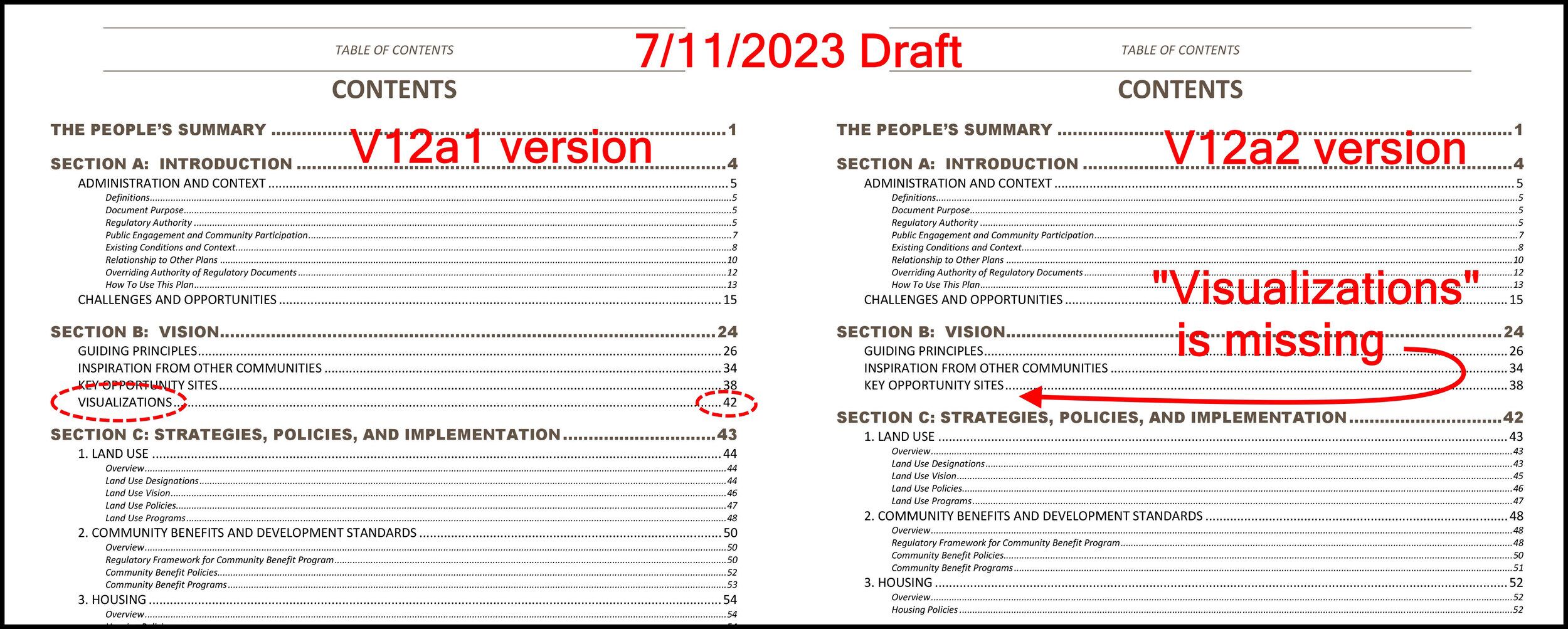
The V12a.2 version of the third draft plan has an updated table of contents. See below for the previous and the current table of contents, as well as the page that was removed.
Of the $34,596 of the budget for 3D modeling, all but $188 has been spent. And we have seen hardly any results. We know that the capability exists, because we have seen a small quantity of very worthwhile images. (See below for some examples.)
It is not just an untrained person who needs a 3D image to visualize a building or a streetscape. All architects and city planners utilize 3D images to evaluate building scale and massing. The McKinleyville Town Center plan has more 3D imagery than we have. It is a now-common tool — and we do not have it.
The Council and Commission are called on to determine building and massing standards and building height figures. What would three or five — or eight — individual five-story buildings look like along K Street? What would be the solar shading? Would the road be like a canyon? Without 3D modeling and images, this cannot be visualized. We’re in the dark here.
Director Loya has explained that we cannot have a 3D image showing build-out of the entire Gateway area, because of budget issues. We understand that. He’s explained that the consultant’s early attempts at 3D modeling were inadequate. I don’t buy it.
At a future time I will explain that Planwest either has done very, very little of the contracted work that Arcata has paid them for — or else they have done the work and we just haven’t seen it. It is a huge missing component to the Gateway planning process.
- No planner in their right mind would try to do what you’ve been asked to do — without 3D modeling. I have not seen a single area plan or town plan that did not have some overall 3D modeling.
- Your task is already difficult. Without some images of what a collection of 6-story or 7-story buildings might look like, your job is impossible.
- I would like to be more helpful here. In my view, you do not have the information and tools that are needed to make a good decision. It is as simple as that.
Thank you for your work. To reiterate: Your job would be five times easier if you had better resources and information.
— Fred Weis
Here are the tables of contents for the two versions of the 7/11/2023 draft.
Below is what had been in the 7/11/2023 draft. Similar to the first and second draft.
Written on this page (highlighting added):
Visualizations
Following public feedback regarding draft Gateway Area Plan, several pages will be added here to display photo‐realistic visualizations of selected opportunity sites and other desirable building types within the Plan Area. Each visualization will may show existing conditions and then envisioned future improvements on the same site. These renderings will be illustrative, will be conceptual, and will not be prescriptive.
And then the page said “PLACEHOLDER” and the page is empty. In all three drafts, the page titled “Visualizations” had been blank. Now the whole page is gone entirely.

Sample 3D images that we have seen
From the first draft plan, December 2021.
This is crude, but effective. Shown in yellow is a hypothetical 6-story building located on the Tomas site (where shipping containers are now) behind the Creamery. We can note the deep 4th-story step-back — now not part of of the Gateway Code.
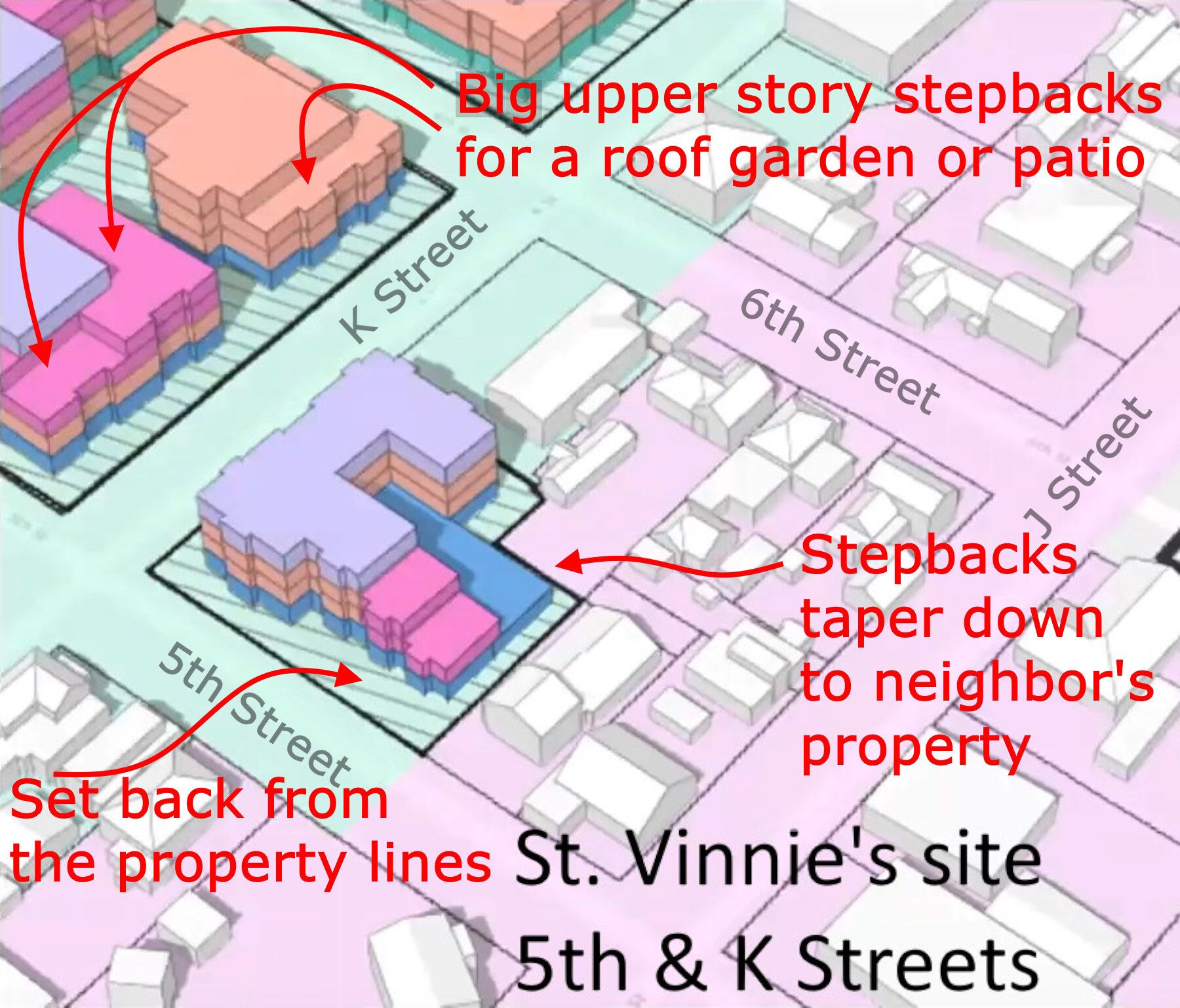
From the Building and Massing video, August 2022 — one year ago.
The red print and arrows were added.

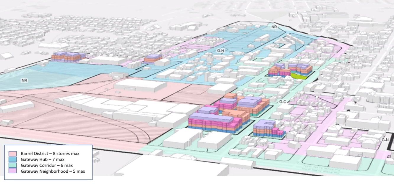
From the Building and Massing video, August 2022
Shows a hypothetical build-out of the St. Vinnie’s site, Bud’s mini-storage site, the AmeriGas site, and the car wash site.
If the trailer court, Clothing Dock/German Motors, and AgSales sites were filled in, we’d begin to get an idea of how multiple buildings would affect the look and feel of Arcata.
Why is it so crucial
There’s a wealth of information in 3-D that is not available in 2D.
Which is more understandable and meaningful to you?
This:
McKinleyville Town Center – Plan view
or this ?
McKinleyville Town Center – 3D overview
or this:
The


