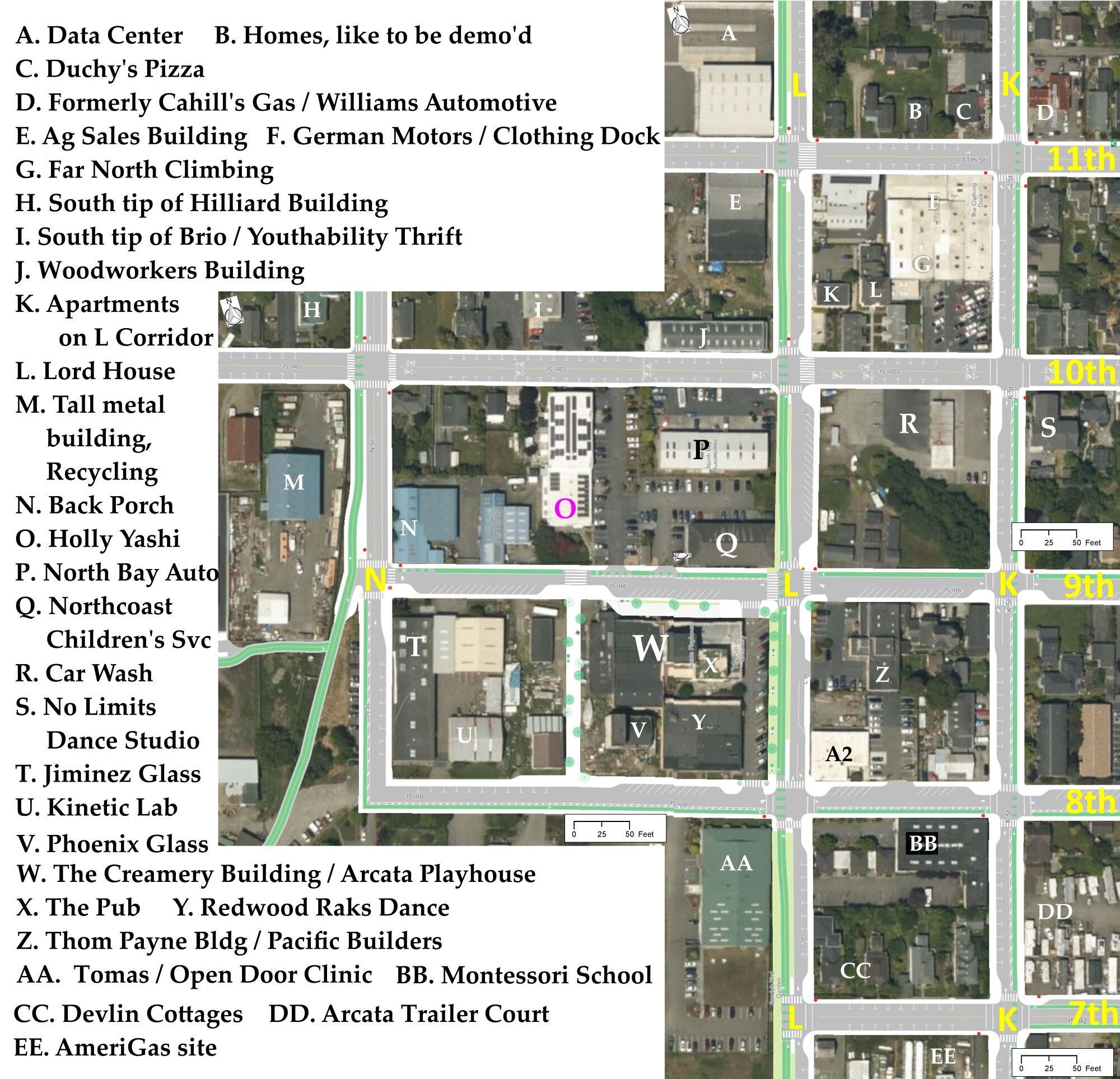
This map provides an orientation for many of the buildings and business locations in the Creamery area.
The background is taken from the Draft Gateway Plan and shows L Street as the “L Street – K Street Couplet” as is proposed in the Draft Plan. This has K Street being a one-lane, one-way truck route thoroughfare headed north, and L Street being a one-lane, one-way truck route thoroughfare headed south. This would have a truck-route road alongside the Creamery Building, the Pub, Redwood Raks, etc. and would pretty much destroy the public space that the Arcata Playhouse Arts group and the Creamery District has been creating over these past many years.
For more information on the alternative to the L -K Street Couplet, see the many articles on this website on the formation of an L Street Linear Park. The Linear Park has been what Arcata’s Transportation Safety Committee has strongly recommended as being of great benefit to Arcata.
This map also shows the proposed on-street parking situation. However, this parking plan is very inaccurate — it is “high level” and does not incorporate driveway cutouts, business frontages, and other aspects of reality.
For more info on the inaccuracy of the parking layout, see the article “Gateway Street Parking: Why it will be inadequate” on this website. As an example, on K Street between 8th and 9th there are about 16 parking spaces currently. If the parking layout as proposed in the Draft Plan were put in place, there would be 2 spaces.
The map

The PDF viewer allows you to expand the map (using the + key) and scroll around, to see more detail.

